
Really? I'm sorry about that - I think I still have the file. I'll check for it sometime this weekend, and get it to you if possible.
Awesome Chris, very nice looking, love the loop.
Yeah, from last weekend, highest track.
Hey Guys,
Here is a google earth comparsion, 2 tracks, lower track=7,401'. High track= 10,868'. Altitudes are from Raven, GPS on this last flight was 400 feet higher. Wish I could share some of the graphs from the Raven with you guys, they are Super Kool. I can't seem to figure out how to export them. (Hint, Hint, Hi Adrian)
In the Featherweight Interface Program, you can right-click in the plot window, and a button will pop up to copy the graph. (and by the way, if you right click in the parameter selection window, it will copy the data for pasting into Excel). From there, I paste into an image viewing program (IrfanView) and save as a .gif, then upload that to an image hosting service (photobucket)
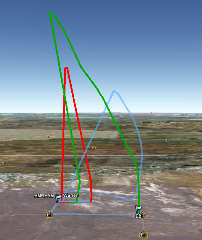
Warren: Here's my GPS data from last Octoberfest. The blue track is yours, the red track is mine, and the green track is Ed's. I also sent you the actual GPS file.
Hey guys,
So i've downloaded my flight from yesterday, Raven and DC30. I was wrong in listening to the Raven beeps, I thought it was 10K, nope it was 11k woot, 11,045' to be exact at my first time through the sound barrier at 803 MPH. Rocket was Little Dawg DD, on a J530-Imax. Here is the track from Garmin in Goggle Earth.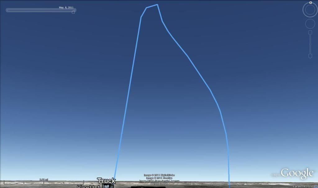
Indeed windy up high.
David,
Check this out, I just found out google Earth can do this: With the track selected, right click and select altitude profile. Remember my altimeter said 9,825? - the GPS says 11,031.
So if you have a Telemetrum, you could do the same thing? I am just looking for other methods or devices to do the same thing.
87.9 MPH 😯 Ken I thing you need a bigger motor! Pretty slow climb to 11000! 😉
Hey Ken,
Yeah, that is really cool, I like the graph it does too!
Hopefully the parrie gets hammered with some of this moisture coming in, fingers crossed!
Latest Post: Hello World Our newest member: everettelist43 Recent Posts Unread Posts
