
Recovered without a scratch, near where Ed's rocket came down. More details and data later.
Based on a transmitter signal that came on 14.5 minutes after launch and went away about a minute after that, I'm pretty sure that the main came out at apogee. Unfortunately, it was a 35" chute, since it was a tight-packing chute I made myself when I thought the rocket weight would be a lot higher, and the calculated descent rate is about 14 feet/second, which roughly matches the 14 minute mark when the chute was supposed to deploy 1200' above the ground.
So I went to the University of Wyoming sounding data website:
http://weather.uwyo.edu/upperair/sounding.html
and calculated where the upper-level winds would have taken it. That data says it landed about 5 miles from apogee, about 40 degrees East of North. Since the rocket went a little to the southeast during the boost, here is my estimate for the landing location, and where I hiked yesterday:
My walking route was about 12 miles, and I climbed 3 of the bluffs to get better vantage points. If there was a 1-foot yellow-green chute within a mile of the bluffs I would have seen it, unless it was hiding in a small gully. The terrain where I think it went is pretty flat. Here's the view toward the launch site from the NE butte I climbed. I climbed the other two buttes in this picture and did a binocular scan from them, also:
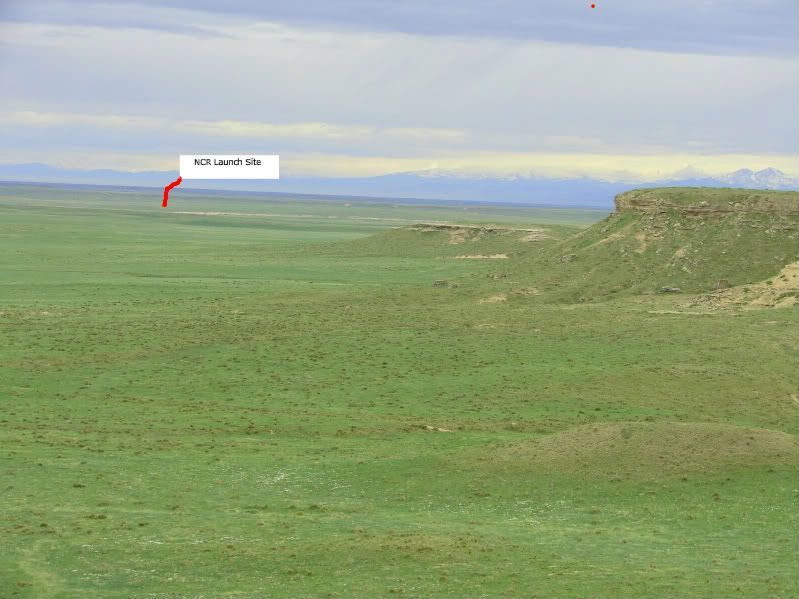
To the left of the red pointer I drew, you can barely make out the access road to the launch pad as it comes down the hill south of the pads.
Here's a view from the southern leg of my walking route looking back North toward the buttes:
 .
.
My binoculars are pretty good, so from the butte I was able to pick out 4" yellow-green flowers at the distance where this picture was taken. I climbed the 2nd from the right, and the 2nd from the left, and a lower table that's off the picture to the left.
A couple more pictures for flavor:
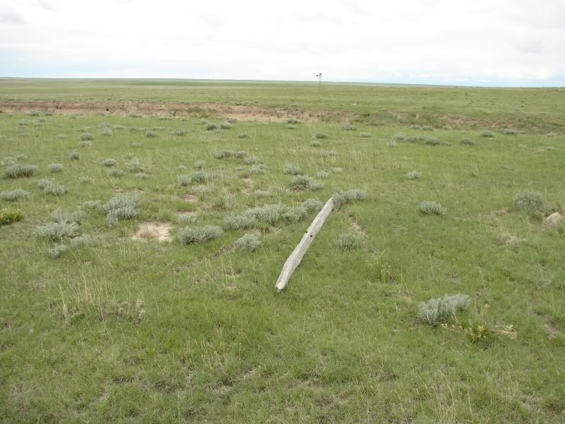
not-a-rocket, though from 3/4 mile away I thought it might be someone's L3
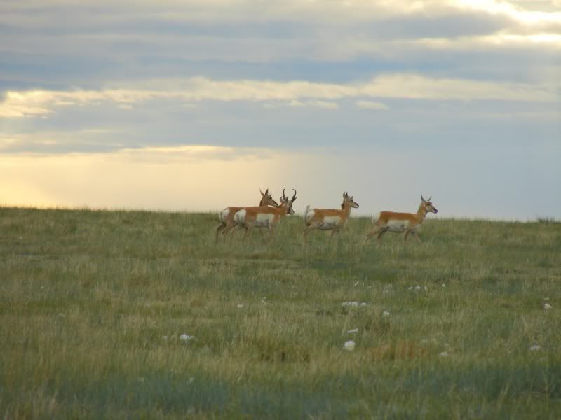
I must have seen 50-100 antelope while I was looking, though maybe some were the same ones. It was kind of neat at first, but I got tired of finding them after awhile. Every time I saw a lighter-colored dot that I thought maybe was a chute, I realized "Oh, it's just another antelope ass."
another antelope ass."
Not looking for that huh?
I hear there's some Sheep north of there! 🙂
Adrian,
First off - nice pictures!
Secondly, I'm not smart enought to dig through that huge collection of weather data. What was the direction and speed of the winds aloft during the flight?
Thanks, Ed.
The winds aloft during the descent varied between about 5-25 knots, coming from about 220 degrees. In other words, the wind carried the rocket about 40 degrees East of North. Based on 14 minutes from apogee of 14kft to loss of signal, I calculate that my rocket went 4.8 miles in that direction. Doing the same for Ed with a 22kft apogee and 17 minutes descent time says that his rocket went about 5 miles, 34 degrees East of North, IIRC. I assumed an 11 AM liftoff for both, so a little better time estimate for Ed's launch should improve the accuracy a bit. This agrees with the radio bearing that Ed got and the general direction of the signal I got. The line on Ed's topo map is pretty much the expected ground track, if the apogee was right over the pad. I think my apogee was a little to the SSE, but I don't remember if Ed's boost had any horizontal component to it.
The main error sources are that the winds were measured over Denver at 6 AM and 6PM, rather than 11 AM at Pawnee. I did a weighted average of the 6AM and 6PM data to adjust for time, and I tried doing a little correction based on wind measurements from the closest stations to the North, which are North Platte NE and Riverton, WY. Those 2 stations are far enough away though, that I don't think they add too much information. Fortunately, all 3 stations reported almost the same wind direction so I'm pretty confident in the bearing.
I'm also concerned that the rockets (mine at least) blew around after landing. I had an oversized chute, so unless it got stuck on a nearby Yucca plant (a pretty good bet) or fence, it could have gone a pretty good distance from the landing point. The predicted landing spot is in terrain that is just rolling enough, has just enough Yucca plants, and is just far enough away from the bluffs that I can believe it's near the predicted spot and my walking search just missed it. But really if it were there I probably would have seen it. Same for Ed's rocket. There is a plan forming for some aerial reconnaissance on Saturday that may do the trick, but I don't have a feel for how effective it can be. The winds blew from all directions between Sunday and Tuesday, so if the rockets blew around after landing, it's anyone's guess where they wound up.
I think your best bet is to hire Mike Bennett 🙂 he would go lower and slower and he'd have an excellent chance of finding stuff. I don't know what it would cost or if he is interested, but he will have a definite advantage overa fixed wing aircraft - he's putzing around at 25-35% of the speed and he can look down directly in front of himself... something not easily done in a Cessna.
That said, a Cessna beats the heck out of walking!
I would love too, not to mention one of the reasons I got into PPG was to look for lost rockets. I however am going on vacation..to of all places Iowa for a visit with the sister-in-law for a week and yes I will be flying there.
After that let me know.
I would love too, not to mention one of the reasons I got into PPG was to look for lost rockets. I however am going on vacation..to of all places Iowa for a visit with the sister-in-law for a week and yes I will be flying there.
After that let me know.
Thanks, Mike. If we don't find it tomorrow, I'd love to use your help for the search.
Violent Agreement has been found! I'm downloading the data now.
Larry Haynes thoughtfully organized an aerial search, and today around mid-day we went up in his friend Steve's Cessna and headed for the hills. Thanks, Steve! Thanks to Ed's good maps, we found the vicinity pretty easily. We were on our second pass over the area (it was probably less than 5 minutes after we arrived) when I spotted the bright yellow-green chute that I had been looking for all day last Sunday and Monday. It was just NE of Ed's rocket landing spot, in the bottom of the wash. A couple more passes to make sure we knew where it was, and we headed back to the Longmont airport (via Greeley for lunch. Good burgers there.)
Special thanks to Ed and his 19 mile trek on Thursday. If it weren't for his transmitter still beeping, I would have continued to waste searching effort SE of the actual landing based on Denver upper level winds (the wind direction wasn't the same 100 miles North of the measurements. Whoda thunk it?)
After the flight, I drove up from Longmont, past the launch site to the end of the road, and set off on foot. Mea culpa here, it turns out this was crossing onto private property, and I hadn't asked permission first. More on that later.
A brisk 3 mile hike later, and I went right to the rocket. It's in fine shape. You can't tell it flew except for some rubs where the launch rails went. The only damage I can see so far from sitting on the ground in the rain is that some of my deployment terminal screws corroded. The interior of the av-bay looks fine. I took my time heading back, stopping to do some binocular scans for bDale's rocket, and to take more pictures. After I made it back out of the bluff area, I saw someone riding an ATV past where I parked my car, and then the ATV approached where I was. It was the owner of the property, Bob Wagner, and he asked what I was doing on his private land. I apologized, expressed confusion over the property boundaries, and then we started talking rockets. I showed him my rocket and answered questions about how high it probably went, what the altimeters were measuring, how accelerometers work, and why the rocket drifted over so far as to be on his property, which led to an explanation of the dual deployment and how the main came out prematurely on my rocket. We talked for quite a while, and I got his number so that we can call to ask for permission if we need to chase a rocket. Permission will not be granted for vehicles or general exploration. Overall, Bob is a very nice guy, with a very reasonable request to ask first before entering his property, and it's a request that should be easy for us to meet now that we have his number. I'm sending a PM to Joe with the number. Everyone, please comply so that we can continue to have Bob's cooperation. Let's invite him to the next Friday Night at the Movies, too; he seemed pretty interested in my description of Odyssey filming as it blew past the clouds.
The property boundary is about 1 1/2 miles North of the pads; I think it's the first fence north of the ATV area. From the road that goes by the launch pads, at the intersection where that road crosses a fence line and turns NE toward the ATV area, there is a 2-lane no-vehicles track that goes due North another mile to the northern edge of the Pawnee National Grasslands. The area north of there is Bob's property.
Both altimeters are done downloading now, so on to the data! I'll start a new thread in the contests area.
Good news Adrian.
You guys sure didn't leave me much to find for today though 🙂
Based on your comments about Bob's property I referenced the owner's map in your "Pawnee Triangle" post. I was planning on hiking in from the North in the M/X section, looks like Bob owns all the Q sections, does that seem right? Was his land fenced, would I know the boundaries? I don't want to stray into that area and cause an issues today.
I had my talk with Bob when I was just west of "L" on the Mike's map. Bob said that the Pawnee National grasslands don't go any farther North than the line at the bottom of L.
Latest Post: Hello World Our newest member: everettelist43 Recent Posts Unread Posts
